California’s Desert Parks by Car: A Practical Guide to Joshua Tree, Death Valley, and the Mojave Preserve
One road loop can take you from cartoon-shaped Joshua trees to dunes that hum under your feet and a basin that sits below sea level. Here is how to string the three parks together without joining a tour bus.
Most visitors to California never make it past the coast, which is understandable. That is fine for them. It leaves the southeastern corner of the state feeling almost empty by comparison. Spread a map on the hood of your car and you’ll see three enormous protected areas sitting within a few hours of one another: Joshua Tree National Park in the south, the Mojave National Preserve in the middle, and Death Valley National Park in the north. Each one is a desert, technically, but that label does not tell you much once you are standing in them. None of them feels like the others once you are actually walking through it. Joshua Tree is boulders and cartoon yuccas. The Mojave Preserve is wide, quiet, and largely untouched. Death Valley is vast, severe, and strangely beautiful in the way that only extreme places can be.
You can hit all three in a single loop out of Los Angeles or Las Vegas. The total driving distance is manageable, the roads are mostly paved, and the trip works in every season if you plan around elevation and temperature. From LA the route follows Interstate 10 east, cuts north on California 62 through Twentynine Palms, threads the preserve on Kelbaker Road, and drops into Death Valley via California 190. What the parks don’t offer is much in the way of gas stations, cell service, or shade. That is the point. You go to feel small, to move slowly, and to realize that “empty” land is usually anything but.
This guide is built for independent travelers: people with a rental car or their own vehicle, a cooler, and a tolerance for dust. I’ll be honest up front — you won’t get a spa weekend. You will get some of the best night skies in the country, roads that point straight at distant mountains, and the rare sense that you are the one choosing what happens next.
Why These Three Parks Work as One Trip
The instinct most people have is to treat Joshua Tree as a weekend escape from Los Angeles and Death Valley as a separate, longer detour. Linking them with the Mojave Preserve in between makes more sense than it looks on paper. The drive from Joshua Tree’s north entrance to the edge of the Mojave Preserve is roughly ninety minutes. The roads are good. From there to Death Valley’s southern boundary is another two hours through empty basins and mountain passes. Spread over four or five days, the mileage never punishes you.
All three are federal lands. They are managed a little differently. Joshua Tree and Death Valley are national parks, so they charge entrance fees, have paved scenic drives, and can get crowded at famous viewpoints. The Mojave National Preserve is also run by the Park Service, but more loosely. It is bigger than Rhode Island, has no entrance gates, and offers some of the most isolated camping in the Lower Forty-Eight. If Joshua Tree is the gateway and Death Valley is the finale, the Mojave Preserve is the quiet stretch in the middle where you remember how much open space is still left.
The best desert trips don’t try to see everything. They pick a few anchor points and leave the rest for next time.
Joshua Tree: Beautiful, Busy, and Worth the Hassle
Joshua Tree is the easiest park to reach and the hardest one to have to yourself. It sits at the intersection of the Mojave and Colorado deserts, which is why you get two very different looks in one park. The western half, at higher elevation, is where the namesake Joshua trees grow alongside enormous granite boulders that look like they were dropped from the sky by a giant who got bored. The eastern half is lower, hotter, and dominated by creosote bush and ocotillo.
The park is popular. You need a plan. Weekends from October through April can feel like a music festival at the main trailheads. Hidden Valley, Barker Dam, and Keys View are all worth seeing, but they fill up by mid-morning. If you want a quieter experience, head south toward the Cottonwood Entrance. The longer trails — Lost Horse Mine or Ryan Mountain — are best started early. The Hidden Valley loop is only a mile, Barker Dam is a little over a mile, and both are flat enough for most people. Cholla Cactus Garden at sunrise is genuinely surreal, and the short loop is forgiving even if you are not much of a hiker.
Camping inside the park is the classic Joshua Tree experience, but it requires advance planning. Most sites are first-come, first-served. The reservable group sites book up months ahead. The National Park Service camping page lists current availability and the handful of campgrounds that take reservations. Outside the park, the towns of Joshua Tree and Twentynine Palms have motels, Airbnbs, and a few decent restaurants. They are not glamorous. They are convenient, though.
The best months to visit are March through May, when wildflowers can appear after wet winters, and October through November, when the heat has broken. Summer is brutal, and unless you already know desert heat, you should skip it. Entrance fees are listed on the National Park Service fees page; an America the Beautiful pass covers admission.
What to skip and what to seek out
Skull Rock is famous because it is right next to the road, which also makes it a traffic bottleneck, so if you have already seen a rock that looks like a face, you can pass it. Instead, try the Wonderland of Rocks area or a sunset walk at Cap Rock. Keys View is a short drive with a big panorama, though the smog from the LA basin sometimes ruins it. On a clear day the view stretches all the way to the Salton Sea and the mountains of Mexico.
The Mojave National Preserve: The Quiet Middle
If Joshua Tree feels busy, the Mojave Preserve will feel like an antidote. It is quieter. There are no entrance stations, no lodges, and only a few paved roads. What you get instead is the Kelso Dunes, the Cinder Cone Lava Beds, Hole-in-the-Wall, and some of the darkest night skies in Southern California. It is not traditional. It is a patchwork of desert valleys, volcanic formations, and old railroad history. Self-reliance is mandatory.
The Kelso Dunes are the obvious highlight. At about seven hundred feet tall, they are the largest dunes in the state, and on a dry day they “sing” as sand slides down the slip face. The hike from the parking area to the top is roughly three miles round-trip with about five hundred feet of gain, which feels steeper than it sounds in loose sand. The view over the surrounding Mojave Desert is worth it. Bring more water than you think you need and start early, because there is no water or services at the trailhead.
Hole-in-the-Wall is another easy win. A short loop trail threads through volcanic rock formations that look like someone punched holes through the canyon walls. Nearby, the Rings Loop Trail uses metal rings bolted into the rock to help you climb down a short slot canyon. It is fun, not technical, and rarely crowded. For something stranger, drive the rough dirt road to the Cinder Cone Lava Beds or the old mining town of Kelso, where the restored depot now serves as a visitor center.
Most camping here is primitive. The Park Service allows dispersed camping in much of the area, meaning you can pull off a dirt road and set up camp for free. There are also a few developed campgrounds like Hole-in-the-Wall and Mid Hills, which have pit toilets and picnic tables but no water. Check the preserve’s camping page first.
There is something restorative about a place where the only light at night comes from stars you forgot existed.
Death Valley: Go Big, Plan Carefully
Death Valley is the largest national park in the contiguous United States and the hottest, driest, lowest place in North America. Those superlatives are fun to repeat, but they also shape every decision you make there. Summer afternoons top 120 degrees. In winter, the higher mountains around the valley can see snow. The park’s elevation range of nearly two vertical miles means you can be sweltering at Badwater Basin and shivering at Wildrose Peak on the same day.
The classic one-day Death Valley sampler starts at Badwater Basin, the lowest point in North America at 282 feet below sea level. From there, hit the Devil’s Golf Course, Artist’s Palette, Zabriskie Point, and Mesquite Flat Sand Dunes. If you have a second day, add Mosaic Canyon, the Racetrack Playa, or a hike into Golden Canyon. The Golden Canyon trail is about three miles round-trip through a narrow gorge walled in by golden mudstone, and it is one of the most rewarding short walks in the park. The Racetrack is famous for its sliding rocks, but the twenty-six-mile dirt road out there is rough and requires a high-clearance vehicle. Do not attempt it in a standard rental car.
Lodging inside the park is limited to Furnace Creek, Stovepipe Wells, and a few remote cabins. Furnace Creek has the most services, including a gas station, a general store, and the park’s main visitor center. Stovepipe Wells is smaller. It is also less expensive. There are also several campgrounds, with Furnace Creek being the only one that takes reservations in the cooler months. The NPS Death Valley planning page has the latest details on camping and lodging.
Before you head into the backcountry, check the current conditions page. Flash floods can close roads in winter and spring, and summer heat can make even short walks dangerous. Carry extra water. Bring a full gas tank and a paper map. Cell service is essentially nonexistent once you leave the paved corridors.
| Park | Entrance fee | Best season | Don’t miss | Main trade-off |
|---|---|---|---|---|
| Joshua Tree | $30 per vehicle, 7 days | Mar–May, Oct–Nov | Hidden Valley, Cholla Garden, Jumbo Rocks | Crowds on weekends |
| Mojave Preserve | Free | Oct–Apr | Kelso Dunes, Hole-in-the-Wall | No services; high clearance helps |
| Death Valley | $30 per vehicle, 7 days | Nov–Mar | Badwater Basin, Zabriskie Point, Mesquite Dunes | Extreme heat; remote back roads |
Building a Loop Itinerary
The simplest version of this trip starts in Los Angeles, drives east to Joshua Tree, cuts north through the Mojave Preserve, spends a couple of days in Death Valley, and then loops back via Las Vegas or Lone Pine. From Las Vegas, you can do it in reverse, starting with Death Valley and ending in Joshua Tree. Either direction works.
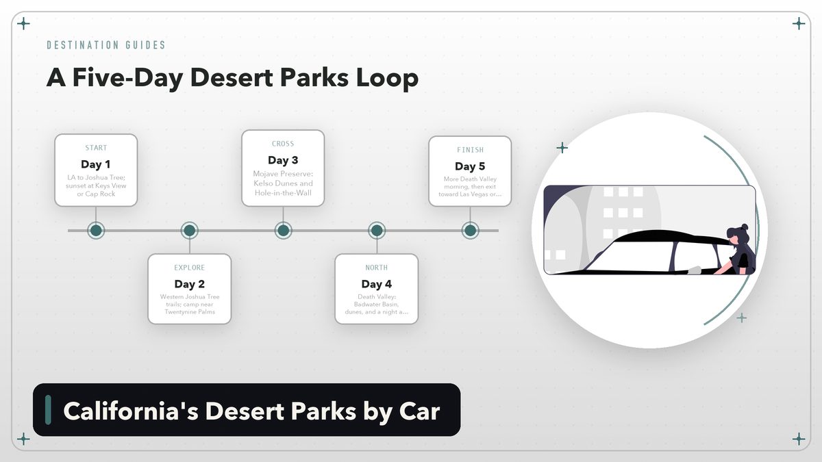
Five-day version. Day one, drive LA to Joshua Tree, catch sunset at Keys View or Cap Rock. Day two, explore the park’s western half and camp or stay in Twentynine Palms. Day three, drive north through the Mojave Preserve, stopping at the Kelso Dunes and Hole-in-the-Wall, then camp at Mid Hills or Hole-in-the-Wall. Day four, continue into Death Valley, visit Badwater Basin and the dunes, and stay at Furnace Creek or Stovepipe Wells, which sets you up for a final morning of exploring before the long drive back. Day five, explore more of Death Valley in the morning, then exit toward Las Vegas or Lone Pine.
Seven-day version. Add an extra day in Joshua Tree for a longer hike or bouldering, a full day in the Mojave Preserve to reach the Cinder Cones or Lava Beds, and a second day in Death Valley for the Racetrack or a sunrise at Zabriskie Point. The extra time also lets you slow down and absorb the scale of the place rather than ticking off viewpoints.
Three-day version. If you only have a weekend, pick two parks. Save the third for another trip. Joshua Tree plus the Mojave Preserve is the easiest combination from LA. Death Valley plus the Mojave Preserve is the easiest from Las Vegas. Trying to squeeze in all three in three days means too much driving and not enough being there.
What to Pack and When to Go
Desert travel is unforgiving. The same sun that makes the landscape look spectacular will also dehydrate you quickly. Carry at least a gallon of water per person per day, and more if you are hiking. A cooler with snacks, sandwiches, and fruit will save you money and time, since restaurant options are sparse once you leave the towns.
For clothing, layers win. Mornings can be near freezing in winter, and afternoons can be warm enough for a T-shirt. A wide-brimmed hat, sunscreen, and sturdy shoes are non-negotiable. If you are camping, bring a tent that can handle wind and cold nights, and use sand stakes in the dunes and dry lake beds. A portable phone battery is useful too, since outlets are scarce and cold drains batteries faster than you would expect in the mountains.
The sweet spot for this loop is late February through April and October through November. Spring can bring wildflower blooms if winter rain has been generous. Fall is clear and mild. Summer is possible only if you stick to early mornings and late evenings, and even then it is unpleasant in Death Valley and the lower parts of Joshua Tree. Winter is beautiful, but higher roads around Death Valley can see enough snow to close passes, so check conditions before you head up.
Final Thoughts
California’s desert parks don’t hand you their beauty the way the coastline does. You have to drive for it, plan for it, and sometimes sweat for it. The reward is a kind of space that is increasingly rare in the American West: roads that go straight toward distant mountains, campsites where the only neighbors are coyotes, and silence so complete it takes a day to get used to it.
Each park can stand alone as a destination. Strung together, they become one of the best independent road trips in the Southwest, and the fact that you can do it all without a tour guide is the whole point. Take your time, carry plenty of water, resist the urge to schedule every hour, and don’t overfill the itinerary. The desert will wait.
All fees and seasons were current as of publication. Always confirm road conditions, camping availability, and entrance fees on the official National Park Service websites before traveling.